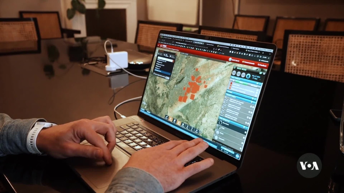
Investigators using satellite imagery to document the war in western Sudan’s Darfur region say 72 villages were burned down in April, the most they have seen since the conflict began. Henry Wilkins talks with the people who do this research about how so-called open-source investigations could be crucial in holding those responsible for the violence to account.
Denial of responsibility! Pioneer Newz is an automatic aggregator of the all world’s media. In each content, the hyperlink to the primary source is specified. All trademarks belong to their rightful owners, all materials to their authors. If you are the owner of the content and do not want us to publish your materials, please contact us by email – [email protected]. The content will be deleted within 24 hours.