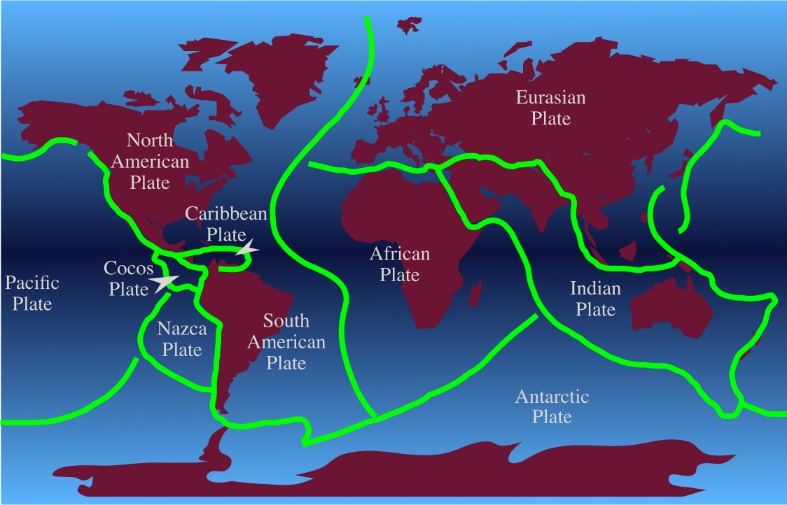
A new study has revealed that the Indian Continental Plate could split in two beneath the Tibetan Plateau.
The revelations were made at the American Geophysical Union conference in San Francisco last December. It was already believed that the Himalayas were growing due to the collision of the Indian and Eurasian continental tectonic plates beneath them.
The research team led by Ocean University of China geophysicist Lin Liu found that the Indian plate is witnessing a dramatic structural separation.
The scientists analysed levels of helium present in the Tibetan springs and earthquake waves under Tibet to study the plate movements. It says that the Indian plate might be “delaminating” as it slides under the Eurasian plate.
Usually, during a collision between two tectonic plates, the denser one subducts beneath the other plate. However, the study says that in this case, the Indian plate’s bottom part may be peeling away from the top as it is “resisting plunging into the mantle while continuing to slide horizontally under Tibet,” according to Science magazine.
This is the first time that the researchers have seen such behaviour in continental plates. The study and its outcome might fundamentally change earth sciences and explain the frequent earthquakes in the region.
Earthquakes tend to happen at the boundaries of tectonic plates, which could be oceanic or continental. In California, the North American plate slides against the Pacific plate along the San Andreas Fault, while in Nepal, the Indian plate crashes into the Eurasian plate.
The Indian plate began to move northward, moving as much as 9 cm/year and eventually ramming into the Eurasian plate millions of years ago. The collision between the two plates is what led to the formation of the Himalaya Mountains.
The Indian plate continues to move to the northeast a couple of inches per year, pushing
the Himalayas even higher as the Indian plate underthrusts the Eurasian plate.
Earthquakes happen when the plates suddenly slip. Most of this happens near the surface, causing much damage. The deeper tremors occur at the top of the mantle, with subduction zones sliding under one another. The earthquake that struck Nepal in 2015 moved Mount Everest by 3 cm to the southwest.
A report by China’s National Administration of Surveying, Mapping, and Geoinformation found the world’s highest mountain effectively bounced backwards following the magnitude 7.8 earthquake that killed thousands in the country.
The report also showed that the second magnitude 7.5 earthquake did not affect the mountain at ll. It did not rise or fall as a result of the earthquake; despite some speculation.
Mount Everest is located on the Eurasian and Indian tectonic plates. These plates are believed to be responsible for its north-eastward shift and rise. Researchers are constantly studying the area for its tectonic movement and its effect on the terrain.


